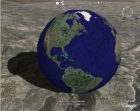

Some of you may have already messed around with Google Earth. I am attaching a link to download the Google Earth program if you don't have it. It's a really cool program used to show locations from satellite view with all kinds of extra information. Here's the link for the program.... http://earth.google.com/download-earth.html
Places to look up once you get it installed
The listings that are given first will show you exactly where we are and have been (of course the islands are still in the plans for a future endeavor)
type the location into the search bar and wait for it, takes a little time to focus from satellite
Triton Yacht Sales Inc. Oriental, NC ( once zoomed in you can just see our boat)
Beaufort, NC (We sail here alot through the Adams Creek Canal) 4-5 hours sail away
New Bern, NC 5-6 hours sail away
Cape Lookout, NC (Through Beaufort inlet and out to the bight, we anchor near the lighthouse) 6-8 hours sail away
Ocracoke, NC (fun inside trip up through the Pamlico Sound) 8-12 hours away
Dry Tortugas ( a place in the Keys that we want to visit with the boat some day) roughly 4 weeks sail away through the Intracoastal Waterway
Bermuda (just to show you where it is, if you don't know)6 to 10 days
Bahamas 4-6 days sail open water
